8 DAYS LEMOSHO KILIMANJARO CLIMBING MOSHI
City: Moshi (Tanzania) Latitude: 37.33022 Longitude:37.33022 Id: 170460 -S:1037
")


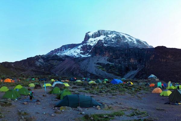


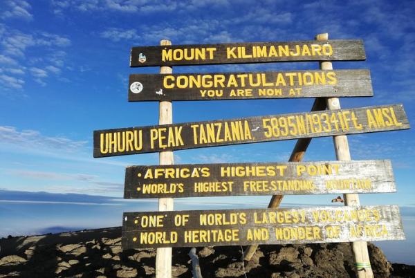
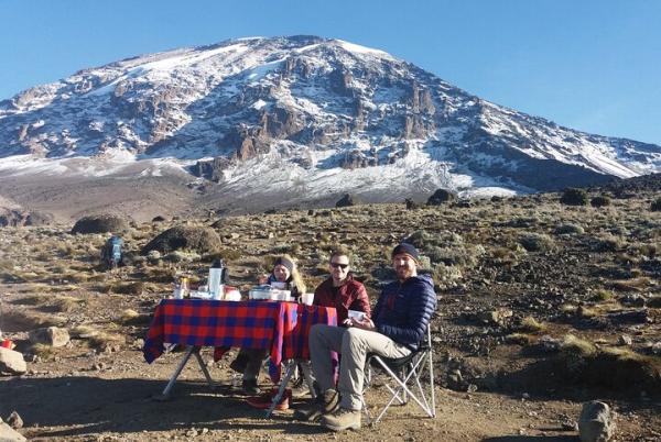
The Lemosho route is considered the most scenic trail in Kilimanjaro mountain, granting panoramic vistas on various sides of the mountain. As one of the newer route, Lemosho is the best choice for your climb. It’s our preferred route due to its ideal balance of low crowds, beautiful scenery and a high summit success rate. It takes 7, 8, 9 and even 12 days to accomplish the hike.
Parking Fees
Start location : At ccm mkoa building End location : At ccm mkoa building
*One per booking
Child : from 7 to 14 : from 0 to 15 Persons
Adult : from 15 to 18 : from 0 to 15 Persons
Adult : from 19 to 40 : from 0 to 15 Persons
Adult : from 41 to 80 : from 0 to 15 Persons
If you cancel at least 4 day(s) before the scheduled departure time, you will receive a full refund.
If you cancel within 3 day(s) of the scheduled departure, you will receive a 0% refund.
Check Availability
Services Included
Additional Information
- Not recommended for travelers with spinal injuries
- Not recommended for pregnant travelers
- Not recommended for travelers with poor cardiovascular health
- Travelers should have at least a moderate level of physical fitness
- Face masks required for travellers in public areas
- Face masks required for guides in public areas
- Social distancing enforced throughout experience
- Temperature checks for travellers upon arrival
- Paid stay-at-home policy for staff with symptoms
Logistics Instructions
Tickets
*Mobile or paper ticket accepted*One per booking
Prices
* Per PersonCancellation Policy
If you cancel within 3 day(s) of the scheduled departure, you will receive a 0% refund.

Contact Us
- +971566917141
- +97143887001
- Send a Message
You may also be interesed in in Moshi


 Transfers")


Featured attractions in Moshi

Moshi Airport
Moshi Airport Virtual tour to Moshi Airport Where you can serach for maps, photos, videos, distances, and other informa
Moshi Airport Virtual tour to Moshi Airport Where you can serach for maps, photos, videos, distances, and other informa
Receive our newsletter with the best offers!
 European euro
 Saudi riyal
 UAE dirham
 United States dollar
We are now looking for the best deals Moshi

